
Wellington's flash floods: why such huge impacts?
It's not just a matter of warnings or not. Digging deeper, we need to ask what makes us so exposed and vulnerable to events like this.

Today is 25 April 2026, and here in Wellington we are still reeling from the destruction wrought by flash flooding in the early hours of last Monday morning. The event caught most people off guard, and many asked why they hadn’t received some warning of it.
Expert meteorologists can comment on the details, but here I offer some quick thoughts on why the event surprised us, and what to do about our high vulnerability to such heavy rainfalls.
The post draws on my article in The Post (Wellington) online and in the print edition 22 April 2026.
See all past posts at reidbasher.substack.com
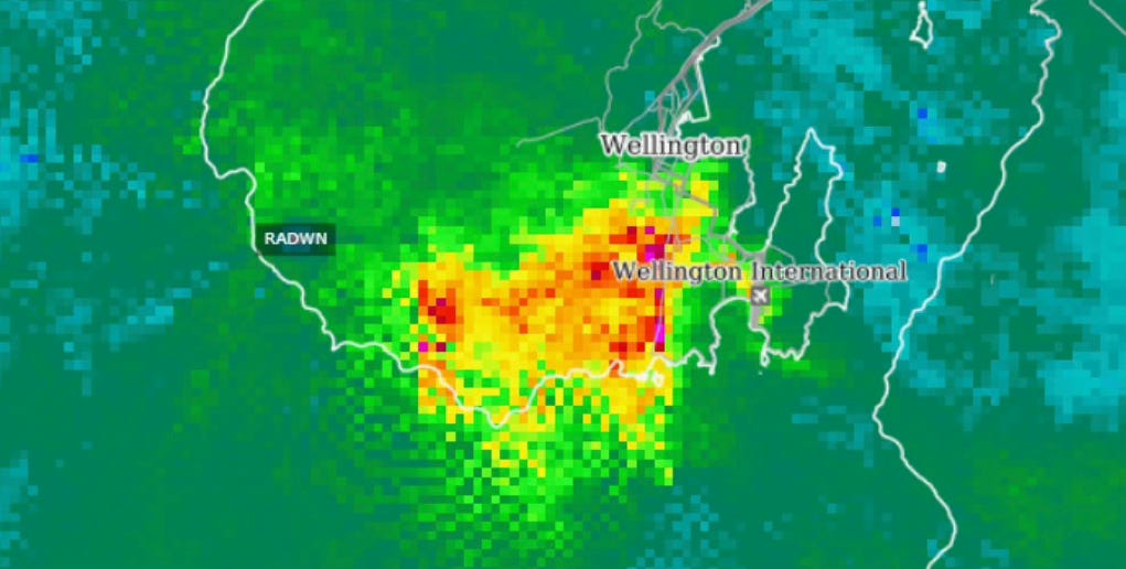
Better warning of flash floods won’t make the rainfall, flooding and landslides go away.
Barely a week ago, we were grappling with Cyclone Vaianu, which caused less damage than initially feared, as I covered in last week’s post.
This week, it’s the opposite: torrential rain and flash flooding in the Wellington region, as illustrated in the radar rainfall map above, caused a lot more damage than anyone expected.
Some residents woke in the early hours of 20 April to flooding inside their bedrooms that rose to a metre or more. People naturally ask why there was so little warning.
The storm was part of a prolonged cold southerly that has been lashing the region with high rainfalls and strong winds for over a week.
The MetService warnings for 20 April are hard to fault. Notably, they included warning of heavy rain and the risk of thunderstorms, and the possibility of worsening conditions that would be a threat to life from dangerous river conditions, significant flooding and slips.
Unfortunately, convective storms like the Wellington event are simply not very predictable, even just a few hours ahead. The possibility of intense downpours, in a broad statistical sense, can be forecast, but not the exact locations or intensities.
This means that everywhere is potentially at risk, but only a few places will get the full works.
If a storm coincides with your suburban valley, such as those in the “hot” areas of the image above, like Berhampore, you could be in for flash floods and landslides, while for the neighbouring suburbs only a couple of kilometres away, it may be “only” heavy rain.
Flash flooding is a recognised danger world-wide and is expected to worsen as climate change raises the air temperature and moisture content of storms.
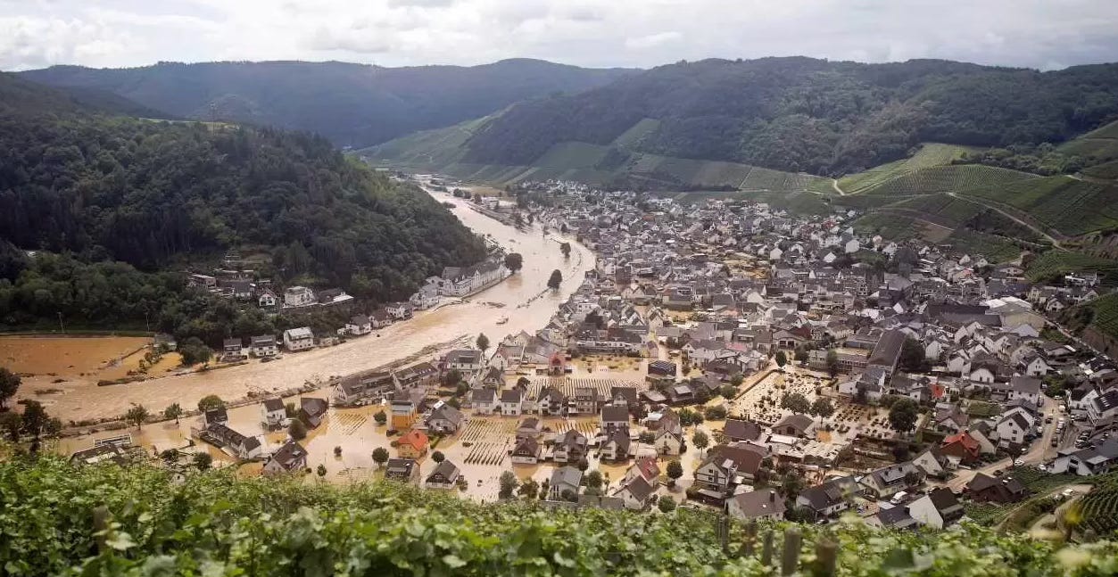
For example, flash flooding in Germany’s Ahr Valley in July, 2021, illustrated above, caused 134 deaths and billions of dollars of damage. Researchers later concluded that climate change had contributed to the disaster, as warming would have increased the rainfall intensity and amounts by as much 19 percent.
Both the Ahr Valley and Wellington storms were very rare, natural events, but made worse by climate change. We will need to be better prepared for similar events as they become more frequent in future.
For more insight on these storms, read these articles on supercharged thunderstorms; what made the Wellington event so intense; and the long recovery from the Ahr Valley storm.
In the future, we can expect better short-term forecasts of storms through what’s called “nowcasting”: automated forecasting an hour or two ahead using data from weather radars, satellites and lightning detectors coupled to AI-based forecasting algorithms. Research is already underway on the technique in NIWA/ESNZ.
Imagine being woken by an automated thunderstorm warning loudly buzzing on your mobile phone, in the same way tsunami warnings do today. It would allow a quick exit with your family, pets and valuables, perhaps also moving your vehicle to safer ground, and would significantly reduce your losses from the storm.
Meanwhile, I think we need better “story-telling” on what might happen when there’s a “risk of thunderstorms” forecast, with examples and memes that lodge in our minds and help us visualise the reality of extreme rainfall and flash flooding. Sadly, many Wellington residents now have such a story, in an intensely personal and painful form.
Finally, a most important point.
Forecasts and warnings do not make the rainfall, flooding and landslides go away.
The latent risk – billions of dollars of it – remains. It is built in, dictated by what’s on the ground facing the deluge and the landslides – our houses, vehicles, roading, infrastructure, drainage, land paved over, etc. By what’s exposed and how vulnerable it is.
But as a community, we have a large degree of control over these things. Surely we can organise ourselves to mitigate the risks and improve resilience?
It will require much greater central and local government leadership and investment than we’ve seen to date, particularly for better drainage and water-retention infrastructure, tighter controls on where and how housing and commercial buildings can be built, and better management of landslide-prone hill-slopes.
Private investment will be needed as well, for example for better site drainage and retaining walls. Insurance premiums increasingly will provide a strong signal on where risks are high and mitigation is needed.
In some cases, existing dwellings may even need to be demolished or relocated. Expect big debates on who pays for that.
This work is called disaster-risk reduction. For a safer, less-costly future, we need to do a lot more of it. Insurance availability will depend on it. Coping with climate change will definitely depend on it.
Here's a comment sent by email "...the question we ask ourselves so often is while we agree with all that you say, and it all makes so much sense, why is it that others do not understand? Why is it that we seem so powerless to actually do something concrete around mitigation strategies, tighter controls on building permits, etc? It can’t all be about ‘money’ and inertia, can it? "
There was a great article in The Post this week about the natural flow pattern of streams. So often nowadays streams are directed through culverts, but in the case of unusually heavy rain the culverts are overcome and the streams then follow their natural path, which may be through someone's house or garden.